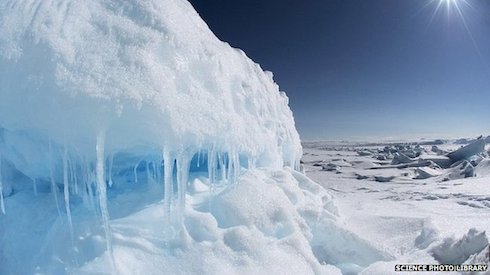
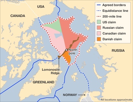
Canada has launched a mission to map the Arctic seabed to support its bid to extend its territory up to the North Pole. The six-week mission comes in the face of competing claims from other countries, including Russia. Two ice-breakers are setting out from Newfoundland to collect data from an undersea ridge that starts near Ellesmere Island and runs to the Pole. The region is believed to include large oil and gas reserves. Last December Canada filed an application with the UN seeking to vastly expand its Atlantic sea boundary. Russia and Denmark have also made competing claims on a vast area of Arctic seabed around the Lomonosov Ridge.
All three countries are seeking scientific proof that the ridge is an underwater extension of their continental shelf. The area is estimated to hold 13% of the world's undiscovered oil and up to 30% of its hidden natural gas reserves. A Canadian government statement said the first icebreaker had left St John's, Newfoundland, on Friday and the second would depart on Saturday. "Our government is securing our sovereignty while expanding our economic and scientific opportunities by defining Canada's last frontier," said Environment Minister Leona Aglukkaq. "This is important to Canadians, especially those in the north, as this is their future and prosperity at stake." Under the UN Convention on the Law of the Sea, a coastal nation can claim exclusive economic rights to natural resources on or beneath the sea floor up to 200 nautical miles (370km) beyond their land territory. But if the continental shelf extends beyond that distance, the country must provide evidence to a UN commission which will then make recommendations about establishing an outer limit. Source URL |