|

|
|
By Pepe Escobar
OpEdNews
Thursday, Jul 28, 2016
The South China Sea is and will continue to be the ultimate geopolitical flashpoint of the young 21st century -- way ahead of the Middle East or Russia's western borderlands. No less than the future of Asia -- as well as the East-West balance of power -- is at stake.
To understand the Big Picture, we need to go back to 1890 when Alfred Mahan, then president of the US Naval College, wrote the seminal The Influence of Sea Power Upon History, 1660-1783. Mahan's central thesis is that the US should go global in search of new markets, and protect these new trade routes through a network of naval bases.
That is the embryo of the US Empire of Bases -- which de facto started after the Spanish-American war, over a century ago, when the US graduated to Pacific power status by annexing the Philippines, Hawaii and Guam.
Western -- American and European -- colonialism is strictly responsible for the current, incendiary sovereignty battle in the South China Sea. It's the West that came up with most land borders -- and maritime borders -- of these states.
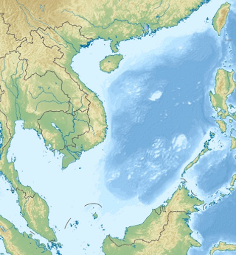 |
| Relief Map of South China Sea
(image by (image by Wikipedia) License DMCA) License DMCA |
The roll call is quite impressive. Philippines and Indonesia were divided by Spain and Portugal in 1529. The division between Malaysia and Indonesia is owed to the British and the Dutch in 1842. The border between China and Vietnam was imposed to the Chinese by the French in 1887. The Philippines's borders were concocted by the US and Spain in 1898. The border between Philippines and Malaysia was drawn by the US and the Brits in 1930.
We are talking about borders between different colonial possessions -- and that implies intractable problems from the start, subsequently inherited by post-colonial nations. And to think that it had all started as a loose configuration. The best anthropological studies (Bill Solheim's, for instance) define the semi-nomadic communities who really traveled and traded across the South China Sea from time immemorial as the Nusantao -- an Austronesian compound word for "south island" and "people."
The Nusantao were not a defined ethnic group; rather a maritime internet. Over the centuries, they had many key hubs, from the coastline between central Vietnam and Hong Kong to the Mekong Delta. They were not attached to any "state," and the notion of "borders" didn't even exist.
Only by the late 19th century the Westphalian system managed to freeze the South China Sea inside an immovable framework. Which brings us to why China is so sensitive about its borders; because they are directly linked to the "century of humiliation" -- when internal Chinese corruption and weakness allowed Western barbarians to take possession of Chinese land.
Tension in the nine-dash line
The eminent Chinese geographer Bai Meichu was a fierce nationalist who drew his own version of what was called the "Chinese National Humiliation Map." In 1936 he published a map including a "U-shaped line" gobbling up the South China Sea all the way down to James Shoal, which is 1,500 km south of China but only over 100 km off Borneo. Scores of maps copied Meichu's. Most included the Spratly Islands, but not James Shoal.
The crucial fact is that Bai was the man who actually invented the "nine-dash line," promoted by the Chinese government -- then not yet Communist -- as the letter of the law in terms of "historic" Chinese claims over islands in the South China Sea.
Everything stopped when Japan invaded China in 1937. Japan had occupied Taiwan way back in 1895. Now imagine Americans surrendering to the Japanese in the Philippines in 1942. That meant virtually the entire coastline of the South China Sea being controlled by a single empire for the first time in history. The South China Sea had become a Japanese lake.
Not for long; only until 1945. The Japanese did occupy Woody Island in the Paracels and Itu Aba (today Taiping) in the Spratlys. After the end of WWII and the US nuclear-bombing Japan, the Philippines became independent in 1946; the Spratlys immediately were declared Filipino territory.
In 1947 the Chinese went on overdrive to recover all the Paracels from colonial power France. In parallel, all the islands in the South China Sea got Chinese names. James Shoal was downgraded from a sandbank into a reef (it's actually underwater; still Beijing sees is as the southernmost point of Chinese territory.)
In December 1947 all the islands were placed under the control of Hainan (itself an island in southern China.) New maps -- based on Meichu's -- followed, but now with Chinese names for the islands (or reefs, or shoals). The key problem is that no one explained the meaning of the dashes (which were originally 11.)
So in June 1947 the Republic of China claimed everything within the line -- while proclaiming itself open to negotiate definitive maritime borders with other nations later on. But, for the moment, no borders; that was the birth of the much-maligned "strategic ambiguity" of the South China Sea that lasts to this day.
"Red" China adopted all the maps -- and all the decisions. Yet the final maritime border between China and Vietnam, for instance, was decided only in 1999. In 2009 China included a map of the "U-shaped" or "nine-dash line" in a presentation to the UN Commission on the Limits of the Continental Shelf; that was the first time the line officially showed up on an international level.
No wonder other Southeast Asian players were furious. That was the apex of the millennia-old transition from the "maritime internet" of semi-nomadic peoples to the Westphalian system. The post-modern "war" for the South China Sea was on.
Gunboat freedom
In 2013 the Philippines -- prodded by the US and Japan -- decided to take its case about Exclusive Economic Zones (EEZs) in the South China Sea to be judged according to the UN Convention on the Law of the Sea (UNCLOS). Both China and Philippines ratified UNCLOS. The US did not. The Philippines aimed for UNCLOS -- not "historical rights," as the Chinese wanted -- to decide what is an island, what is a rock, and who is entitled to claim territorial rights (and thus EEZs) in these surrounding waters.
UNCLOS itself is the result of years of fierce legal battles. Still, key nations -- including BRICS members China, India and Brazil, but also, significantly, Vietnam and Malaysia -- have been struggling to change an absolutely key provision, making it mandatory for foreign warships to seek permission before sailing through their EEZs.
And here we plunge in truly, deeply troubled waters; the notion of "freedom of navigation."
For the American empire, "freedom of navigation," from the West Coast of the US to Asia -- through the Pacific, the South China Sea, the Malacca Strait and the Indian Ocean -- is strictly subordinated to military strategy. Imagine if one day EEZs would be closed to the US Navy -- or if "authorization" would have to be demanded every time; the Empire of Bases would lose "access" to...its own bases.
Add to it trademark Pentagon paranoia; what if a "hostile power" decided to block the global trade on which the US economy depends? (even though the premise -- China contemplating such a move -- is ludicrous). The Pentagon actually pursues a Freedom of Navigation (FON) program. For all practical purposes, it's 21st century gunboat diplomacy, as in those aircraft carriers showboating on and off in the South China Sea.
The Holy Grail, as far as the 10-member Association of Southeast Asian Nations (ASEAN) is concerned, is to come up with a Code of Conduct to solve all maritime conflicts between Philippines, Vietnam, Malaysia, Brunei and China. This has been dragging on for years now because mostly the Philippines wanted to frame the Chinese under a set of binding rules but was only ready to talk until all ten ASEAN members had agreed on them first.
Beijing's strategy is the opposite; bilateral discussions to emphasize its formidable leverage. Thus China assuring the support of Cambodia -- quite visible early this week when Cambodia prevented a condemnation of China regarding the South China Sea at a key summit in Laos; China and ASEAN settled for "self-restraint."
Watch Hillary pivoting
In 2011 the US State Department was absolutely terrified with the planned Obama administration withdrawals from both Iraq and Afghanistan; what would happen to superpower projection? That ended in November 2011, when then Secretary of State Hillary Clinton coined the by now famous "pivot to Asia."
"Six lines of action" were embedded in the "pivot." Four of these Clinton nicked from a 2009 report by the Washington think tank CSIS; reinvigorating alliances; cultivating relationships with emerging powers; developing relationships with regional multilateral bodies; and working closely with South East Asian countries on economic issues. Clinton added two more: broad-based military presence in Asia, and the promotion of democracy and human rights.
It was clear from the start -- and not only across the global South -- that cutting across the rhetorical fog, the "pivot" was code for a military offensive to contain China. Even more seriously, this was the geopolitical moment when a South East Asian dispute over maritime territory intersected with the across-the-globe confrontation between the hegemon and a "peer competitor."
What Clinton meant by "engaging emerging powers" was, in her own words, "join us in shaping and participating in a rules-based regional and global order". This is code for rules coined by the hegemon -- as in the whole apparatus of the Washington consensus.
No wonder the South China Sea is immensely strategic, as American hegemony intimately depends on ruling the waves (remember Mahan). That's the core of the US National Military Strategy. The South China Sea is the crucial link connecting the Pacific to the Indian Ocean, the Persian Gulf and ultimately Europe.
And so we finally discover Rosebud -- the ultimate South China Sea "secret." China under Clinton's "rule-based regional and global order" effectively means that China must obey and keep the South China Sea open to the US Navy.
That spells out inevitable escalation further on down the sea lanes. China, slowly but surely, is developing an array of sophisticated weapons which could ultimately "deny" the South China Sea to the US Navy, as the Beltway is very much aware.
What makes it even more serious is that we're talking about irreconcilable imperatives. Beijing characterizes itself as an anti-imperialist power; and that necessarily includes recovering national territories usurped by colonial powers allied with internal Chinese traitors (those islands that The Hague has ruled are no more than "rocks" or even "low-tide elevations").
The US, for its part, is all about Exceptionalism and Manifest Destiny. As it stands, more than Russia's western borderlands, the Baltics or "Syraq," this is where the hegemon "rules" are really being contested. And the stakes couldn't be higher. That'll be the day when the US Navy is "denied" from the South China Sea; and that'll be the end of its imperial hegemony.
Source URL
|
 Print This Print This
|
If you appreciated this article, please consider making a donation to Axis of Logic.
We do not use commercial advertising or corporate funding. We depend solely upon you,
the reader, to continue providing quality news and opinion on world affairs. Donate here
|
|
World News

|

 Print This